Unknown's avatar

About wjduquette

Author, software engineer, and Lay Dominican.

Ring of Fire

As evening sets in….

The smoke cleared out of the valley around noon, and now it’s fairly clear. There’s still a lot of smoke coming off of the mountain side at the top of Pickens Canyon (Briggs Terrace/Ocean View). Jane’s over visiting friends where she can get a pretty good view; I might have more information later.

There are little bits and thin lines of flame along the ridge line of Mt. Lukens; many of them have been burning since yesterday afternoon, but there are some further west, near the antennas. The wind, such as it is, is blowing gently up the hill, so the flames aren’t spreading quickly. I understand that it’s very difficult for the helicopters to get up that high or I’ve no doubt that they’d be waterbombing at least part of the line.

Current stats: 42,500 acres and 18 homes destroyed (not sure where, not here). All the local schools are closed tomorrow, as is JPL.

So, could be better; but from La Crescenta’s point of view it could be so very much worse. God be praised.

A Hazy Shade of Fire

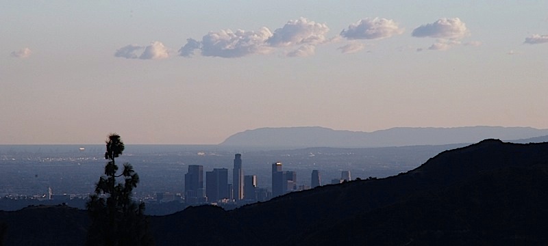
Yesterday afternoon the air at our house was fairly clear, but last night the smoke settled down into the valley, as it’s been doing the last couple of days.  It’s the densest smoke we’ve had so far, and it extends much further.  Yesterday, the smoke was hugging the mountain; down the hill, the air was much clearer.  This morning I took a drive down through La Canada to Pasadena, and then along the 134 Freeway back to Glendale and then back up to La Crescenta; and there was smoke everywhere.  It was a little clearer along the 134.

We didn’t evacuate over night, though I had a scare early in the morning; a little after 2:30 a police car flashed its lights and ran its siren for a few seconds outside our house and moved on.  I jumped out out of bed, cried “It’s time!” and almost got everybody up.  But we checked the web, and called the emergency information center in Glendale, and discovered that we were still outside the evacuation zone; as indeed we remain.

I gather that the fire is still burning, over toward Pickens Canyon and on the ridges above us; after all, where there’s smoke there’s fire, and there’s certainly smoke.  But the smoke is so thick and so diffuse (and so widespread) that I’ve been completely unable to get any idea where the fire is.

I’ve been listening to KNX 1070 since around 3 AM.   Most of the news is about Acton in the Antelope Valley–the fire ran north over night, all the way across the San Gabriels.  There’s been very little that’s new about La Crescenta, though there have been a few mentions of the fire being about 200 yards above the corner of Ocean View and Castle Road in La Canada.  I suppose no news is good news.

It’s supposed to hot again today, over 100, with winds around 10 miles per hour.  I know the winds are bad for the fire fighter, but I’d dearly love to have this smoke cleared away.

Finally, all Glendale schools are closed tomorrow (it was supposed to be the first day of school).  The school district will be deciding when to open the schools on a day-to-day basis.

Update: the City of Glendale has lifted the mandatory evacuation of homes about Santa Carlotta from Pennsylvania to Lowell, which is very good news. On the other hand, the neighborhood above Harmony from Briggs to Pennsylvania is now under mandatory evacuation; that’s about three blocks above our house. Not so good.

Fire Update

Let’s see. The neighborhood three blocks to the west of our house was put under mandatory evacuation a little after 2PM. I think that was premature; we’ve just been out looking, and the southern face of Mt. Lukens to the west of here looks just fine. That neighborhood is in Glendale, and we are not, or I expect we’d have been told to evacuate as well.

However, there is now fire on the south face of Mt. Lukens directly to the north of our house. It’s quite a ways up the hill, and there are many, many blocks of houses in between; but it’s up there. It hasn’t come up over the top of the ridge as I’d feared it was going to this afternoon; it’s been creeping very slowly along the mountain face from the east all afternoon.

At this point we are packed and ready to go if need be. I don’t really think that we’ll need to go; but we’re ready if need be. Here are my expectations:

  • Most likely: we sleep here tonight, we sit around all day tomorrow watching the fire (and maybe the day after that) and we never evacuate.
  • Possible but I don’t expect it: we are told to evacuate and we do; and after the fire has passed we return to our home.
  • Least likely: we evacuate and our house burns to the ground. I say least likely, because if this happens hundreds or thousands of houses would probably burn as well, and the fire-fighters are working really hard to prevent that.

In none of these three cases do any of us die; in all of them, we get away with the things that are most precious. God will be with us.

Whatever happens, we’re ready.

More Fire News

The south slope of Mt. Lukens is seriously on fire. (We live lower down on the south slope of Mt. Lukens.) This is seriously not good.

Update: Possibly, I’m mistaken; my angle of view from here is not good. I can’t tell whether the fire is on the south slope of Mt. Luken, coming from behind a ridge that’s between our house and the peak (with the clouds of smoke blocking the peak) or whether it’s actually behind the peak, but peak is behind the ridge. I’m sure hoping that it’s the latter.

Update: Yes, I was mistaken. I can see the radio antennas on the peak of Mt. Lukens; the smoke is coming from behind them. It’s not nearly as bad as I’d feared, praise God.

Fire News

This morning, like yesterday morning, was so smokey it looked foggy outside when I got up this morning…but enough of the odor crept inside that I knew better. It has cleared somewhat since then, but it’s still very smokey, and whenever there’s a slight breeze there’s a swirl of ash in the air.

Around 10 AM I went out in the car to have a look at things. We live in a valley, so there’s no end of places with a good view that are completely out of the way, being on the other side. From what I could tell, the fire is at its worst in the Arroyo Seco behind JPL, and is creeping up the slopes of the San Gabriels on the northeast, toward Altadena. (I saw isolated smoke and the occasional flame way up at the ridge line on that side.) I also saw what looked like a couple of isolated small plumes to the west of Angeles Crest Highway. I gather the areas there near the top of Alta Canyada were evacuated, and I think that’s where the plumes were.

There appears to be no fire moving toward La Crescenta at the present time; as I understand it, the west edge of the fire is already past, moving west down Big Tujunga Canyon behind Mt. Lukens. However, all of the smoke and ash from the Arroyo Seco is wafting gently in our direction, turning the sunlight red and making it rather unpleasant around here.

The air is much better not very far down the hill; but that’s a relative statement. It’s like a really bad smog day all over Los Angeles. We’d like to take the kids somewhere, but we’re kind of at a loss. We spent most of the last week in museums, and you can hang out at the mall only so long.

Update: It occurs to me that I haven’t mentioned the constant drone of helicopters and airplanes fighting the fire…but we like those, yes we do. They are not a problem.

The Glow


20090827-195633.jpg

Originally uploaded by will.duquette.

Here’s the same ridge line, taken with a long exposure after sundown. The fire looks brighter than it really was…but not too much brighter.

According to the radio, no homes are in danger at the moment. Prayers are welcome.